


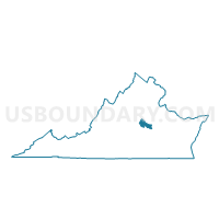
Centerville Voting District, Goochland County, Virginia
About
Outline

Summary
| Unique Area Identifier | 681748 |
| Name | Centerville Voting District |
| County | Goochland County |
| State | Virginia |
| Area (square miles) | 41.66 |
| Land Area (square miles) | 41.26 |
| Water Area (square miles) | 0.39 |
| % of Land Area | 99.06 |
| % of Water Area | 0.94 |
| Latitude of the Internal Point | 37.68591240 |
| Longtitude of the Internal Point | -77.73121310 |
Maps


Graphs
Select a template below for downloading or customizing gragh for Centerville Voting District, Goochland County, Virginia


Neighbors
Neighoring Voting District (by Name) Neighboring Voting District on the Map
- Causeway Voting District, Henrico County, VA
- Crozier Voting District, Goochland County, VA
- Farrington Voting District, Hanover County, VA
- Goochland Court House Voting District, Goochland County, VA
- Lauderdale Voting District, Henrico County, VA
- Manakin Voting District, Goochland County, VA
- Nuckols Farm Voting District, Henrico County, VA
- Rockville Voting District, Hanover County, VA
- Shady Grove Voting District, Henrico County, VA
- Sheltons Mill Voting District, Louisa County, VA
- Short Pump Voting District, Henrico County, VA
- West End Voting District, Henrico County, VA
Top 10 Neighboring County Subdivision (by Population) Neighboring County Subdivision on the Map
- Three Chopt district, Henrico County, VA (72,035)
- Tuckahoe district, Henrico County, VA (55,731)
- South Anna district, Hanover County, VA (14,069)
- District 5, Goochland County, VA (4,741)
- Mountain Road district, Louisa County, VA (4,445)
- District 4, Goochland County, VA (4,267)
- District 3, Goochland County, VA (4,163)
Top 10 Neighboring Place (by Population) Neighboring Place on the Map
Top 10 Neighboring Unified School District (by Population) Neighboring Unified School District on the Map
- Henrico County Public Schools, VA (306,935)
- Hanover County Public Schools, VA (99,863)
- Louisa County Public Schools, VA (33,153)
- Goochland County Public Schools, VA (21,717)
Top 10 Neighboring State Legislative District Lower Chamber (by Population) Neighboring State Legislative District Lower Chamber on the Map
Top 10 Neighboring State Legislative District Upper Chamber (by Population) Neighboring State Legislative District Upper Chamber on the Map
- State Senate District 17, VA (232,435)
- State Senate District 4, VA (209,635)
- State Senate District 12, VA (207,618)
- State Senate District 10, VA (200,686)
Top 10 Neighboring 111th Congressional District (by Population) Neighboring 111th Congressional District on the Map
Top 10 Neighboring Census Tract (by Population) Neighboring Census Tract on the Map
- Census Tract 2001.29, Henrico County, VA (11,764)
- Census Tract 2001.20, Henrico County, VA (7,805)
- Census Tract 2001.30, Henrico County, VA (7,140)
- Census Tract 9505, Louisa County, VA (6,340)
- Census Tract 4001, Goochland County, VA (6,228)
- Census Tract 4002, Goochland County, VA (4,264)
- Census Tract 3203, Hanover County, VA (4,061)
- Census Tract 2001.23, Henrico County, VA (3,032)
Top 10 Neighboring 5-Digit ZIP Code Tabulation Area (by Population) Neighboring 5-Digit ZIP Code Tabulation Area on the Map
- 23059, VA (31,919)
- 23233, VA (28,908)
- 23238, VA (25,134)
- 23103, VA (4,634)
- 23146, VA (3,093)
- 23102, VA (2,659)
- 23039, VA (1,056)
- 23129, VA (374)